Changed URL to use Box with Zotero

For my scientific writing I’m using Zotero to keep track of the bibliographical data of everything I read and of all the references in my own documents. I suppose everybody does that. Or at least I hope so – for your own best! If you don’t, you should start. And if you’re using commercial packages like EndNote to do that you should consider changing to Zotero and doing something useful with the money you save. Seriously.

Anyways, I had been using the cloud storage service box.net to store the liked documents (mostly PDF files) cataloged in my Zotero database from early 2011 and hadn’t touched my Zotero configuration since then. This setup had been working flawlessly for almost three years now. It was only today that I noticed that tiny red exclamation mark in the upper right corner of the Zotero interface, which informed me that something with my synchronization wasn’t working anymore.
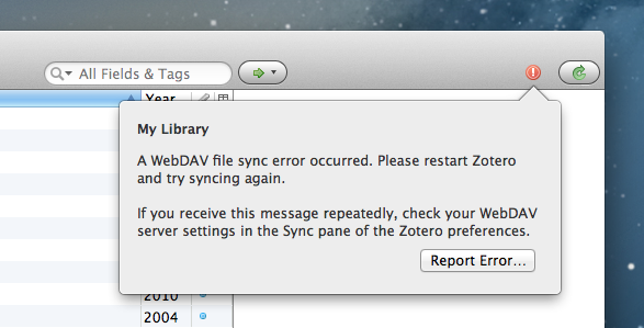
Zotero ran into a WebDAV file sync error

Zotero ran into a WebDAV file sync error

Continue reading →

Upcoming Event: 2014 Annual Meeting of the Association of American Geographers (AAG)

Readers of my blog know that I have been attending the Annual Meeting of the Association of American Geographers (AAG) for the past two years. While these meetings took place in some of the largest and most international cities in the USA (New York in 2012 and Los Angeles in 2013), the AAG decided to hold the 2014 meeting in Tampa, FL. There’s nothing wrong with this – I love Florida and it should be nice and warm there in early April – but I can’t help but be a little afraid that the city will be more or less overrun by geographers over the course of the conference week. Also, there seem to be mostly two types of accommodation in Tampa: either luxury hotels that break my budget (even at the “discounted conference rate” of USD 199 per night in select hotels) or shady motels far away from the conference venue…

Continue reading →

Setting up QGIS 2 on MacOS X 10.9 Mavericks

[UPDATE: Find informations about installing QGIS 2.4 in this newer article.]

After a hardware failure on my MacBook Pro’s hard disk in the end of last year (replaced for free within half a day at the Apple Store, thanks to my Apple Care Protection Plan) and an extended christmas and new year holiday I’m currently being struck down by a nasty cold and hence decided I have some spare time on my hands to give the latest Mac OS X version 10.9 “Mavericks” a try. It had been released in October, but I had been too busy to play around with it, so far. Obviously I’m not going to screw up my main production machine, the iMac, but instead designated my old, trusted MacBook Pro to be the guinea-pig.

Continue reading →

The Power of Subqueries in PostgreSQL

I’m pretty sure everything I’m writing here is true for most other RDBMS, too, but since I’m currently using PostgreSQL I had a chance to test it and show some hard figures here.

The problem to solve is actually a common one and rather easy to solve conceptually: Take attributes from table1 and store them in corresponding rows in table2, using a common id to join them. The straight-forward (and almost direct) translation into SQL is therefore:

UPDATE schema.table1 a 
SET attribute = b.attribute 
FROM schema.table2 b 
WHERE a.id = b.id;

There’s nothing wrong with that statement and it’s going to do exactly what’s intended. Only, it’s not very clever, and hence not very performant. This obviously only matters if your tables are on the bigger end. In my case table1 (the one to update) has 576,806 rows while table2 (the one providing the attribute data) has a whopping 848,664,485 rows. Also I should mention that table2 contains multiple rows for each corresponding row in table1. In that concrete case table2 contains data about point locations (latitude, longitude, timestamp) of people whose attributes (age, gender, etc…) are stored in table1. And there is this one attribute which is wrongly and inefficiently stored with each point location, while it is only dependent on the person and should hence be stored there.

Continue reading →

Running Gephi 0.8.2-beta on MacOS X 10.8.5 Mountain Lion

For my research I’m recently doing a lot of graph and network analysis. So far the tools in ESRI ArcGIS have been sufficient for what I was trying to achieve. I used their Network Analyst Extension and also the Urban Network Analysis toolbox by the City Form Lab at the MIT/SUTD for a more scientific application: the calculation of centrality measures. While these warrant some more in-depth articles in themselves, here I’d like to put a more technical focus on a really annoying problem when using Gephi on a more recent MacOS X system.

Continue reading →