Using Map Tile Servers in QGIS 2.4

As I explained in a comment on my previous article, the otherwise fantastic OpenLayers plugin is currently not compatible with the freshly released QGIS 2.4 unfortunately. This means two things:

  1. You can’t open any QGS project files that contain a reference to such an OpenLayers base map.
  2. You can’t use it to insert OpenLayers base maps (e.g. OSM, Google, Bing, Stamen, Yahoo, …) into your new map projects anymore.

Continue reading →

The Short Way to QGIS 2.4 Chugiak on MacOS

Today I finally found some breathing room in my projects to dare updating my MacBook Pro (running MacOS X 10.9.4 Mavericks) from QGIS 2.0 (Dufour) to the recently released version 2.4 (Chugiak). Well, to be honest I also realized that I should update to be able to use the QgsFeatureRequest.setFilterExpression() method to make use of filtering expressions (introduced in version 2.2).

The first step was to download the installer images for QGIS 2.4 and GDAL 1.11 from KyngChaos.

The GDAL disk image contains not only the complete GDAL framework (including the GEOS, PROJ, SQLite and UnixImageIO frameworks), but also NumPy. Since version 1.6.2-1 is dated from end of August 2012 I decided to skip installing, since I installed my NumPy later than that and should therefore be up to date already. The GDAL installation worked without a problem.

Next step was the installation of the actual QGIS 2.4. The readme files recommend to delete any existing QGIS.app file from the Applications folder, so that’s what I did. The installer then confronted me with this error message: "QGIS requires the Matplotlib python module (kyngchaos build)."
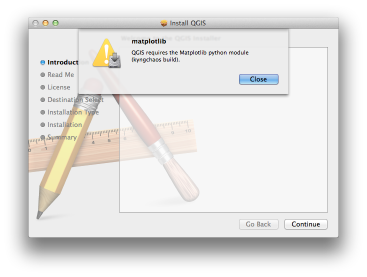
matplotlib python module required

matplotlib python module required

Luckily matplotlib 1.3.1-2 from early 2014 can also be found on the KyngChaos website, so I installed that from the disk image (root authorization necessary) and went back to the QGIS installer. When the installer presented me the readme file once again I realized that I had apparently just read over the hint that not only NumPy but also the matplotlib python module was required – classic user error on my end!

The QGIS installer also requires root authorization, takes few minutes and about half a gigabyte of hard disk space. After the small hickups earlier it finished without a problem, and I was presented first with the beautiful new splash screen and then the GUI itself. Side note: I love the fact that QGIS remembered all my settings regarding toolbars, window locations etc.!
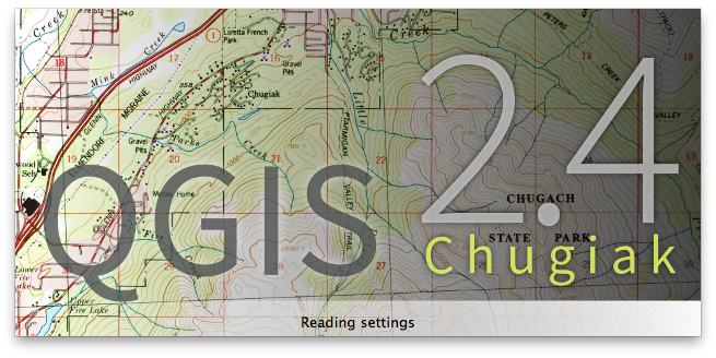
QGIS 2.4 Chugiak splash screen

QGIS 2.4 Chugiak splash screen

QGIS 2.4 GUI fresh after installation

QGIS 2.4 GUI fresh after installation

Huge thanks and props have to go to the team behind QGIS – I can’t wait to look for reasons to try out all the new features. For a quick overview I can recommend Nyall Dawsons blog, whose most recent blog articles provide both an overview of and also some details about what’s new in QGIS 2.4.

Creating Multiple Concentric Ring Buffers in PostGIS

Whenever possible I recently try to get all my GIS work done in QGIS. Most of the time this is no problem at all. Sometimes it makes things even easier, such as when you’re trying to work with your geospatial data in a PostgreSQL/PostGIS database (good luck trying that in ArcGIS!). But sometimes you come across a task that is just so exotic that nobody has ever come across it. Or at least nobody wrote about coming across it…

Continue reading →

Using Tokyo

In the introduction to the UN HABITAT report State of the World’s Cities 2012/2013: Prosperity of Cities it is written:

“As the world moves into the urban age, the dynamism and intense vitality of cities become even more prominent. A fresh future is taking shape, with urban areas around the world becoming not just the dominant form of habitat for humankind, but also the engine-rooms of human development as a whole. This ongoing evolution can be seen as yet another assertion, albeit on a larger scale, of the time-honoured role of cities as centres of prosperity. In the 21st as in much earlier centuries, people congregate in cities to realize aspirations and dreams, fulfil needs and turn ideas into realities.”
(United Nations 2012, v)

I could not agree more, and this is one of the reasons that I was captivated by cities from an early age, long before I started my academic career – or even had an idea of what an academic career is, for that matter. Cities interest me, cities fascinate me, and cities defined me. Having lived in Munich, Frankfurt, and Tokyo, and having visited many other amazing specimen worldwide has definitely had an impact on me and taught me many things. Studying cities is never boring and continues to surprise and astonish me on a regular basis.

Continue reading →

Setting up QGIS 2 on MacOS X 10.9 Mavericks

[UPDATE: Find informations about installing QGIS 2.4 in this newer article.]

After a hardware failure on my MacBook Pro’s hard disk in the end of last year (replaced for free within half a day at the Apple Store, thanks to my Apple Care Protection Plan) and an extended christmas and new year holiday I’m currently being struck down by a nasty cold and hence decided I have some spare time on my hands to give the latest Mac OS X version 10.9 “Mavericks” a try. It had been released in October, but I had been too busy to play around with it, so far. Obviously I’m not going to screw up my main production machine, the iMac, but instead designated my old, trusted MacBook Pro to be the guinea-pig.

Continue reading →